
- Overview
- Trip Outline
- Trip Includes
- Trip Excludes
- Gallery
- Reviews
- Booking
- FAQ
Three days trekking, starting from Namoly Valley and finishing in Tsaranoro Valley
- Day 1:
Approximately 4 hours of four wheel drive, 4 hours walk and about 862m+ ascent & 250m- of descent - Day 2:
9 hours walk and 1 000m+ of ascent& 1 400m- of descent - Day 3:
5 hours walk and 140m+ of ascent& 850m-of descent - Additional Information
Hiking in the Andringitra National Park requires a good level of fitness and stamina. The paths are very well maintained by the park office but can be quite steep in places and you will be hiking for many hours each day. Some people might also be affected by the altitude over 2000m with less oxygen in the air. In addition, for most of the time you are carrying your day pack with you; the additional load on your back makes the climbs even harder. A large part of the path consists of rocky steps built by the park office; the rest of the path might require some scrambling over rocks and walking downhill on slippery rock surfaces. Previous hill walking experience is therefore required for this trek. Waterproof hiking boots that offer a good grip on the rock are an absolute must, too.
In general the evening, at nigh and the morning are cold in Andringitra. Particularly, in Andriampotsy campsite at an altitude of 2050m, it can be very cold in the evening and at night (0 degrees or even slightly below); make sure to bring warm clothes and a good sleeping bag with you. It can also rain at times; don’t forget to pack a rain jacket, rain trousers and rain cover for the backpack. However, you shouldn’t pack many unnecessary items either. Functional, light and quick-drying hiking clothes are recommended.
The campsites are very basic. They have drop toilets and water from the river (no showers). Our support team will heat some water for you to wash upon arrival at the campsite.
No details found.
Itinéraires
Day 1
Approximately 4 hours of four wheel drive, 4 hours walk and about 862m+ ascent & 250m- of descent
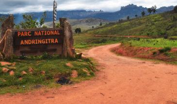
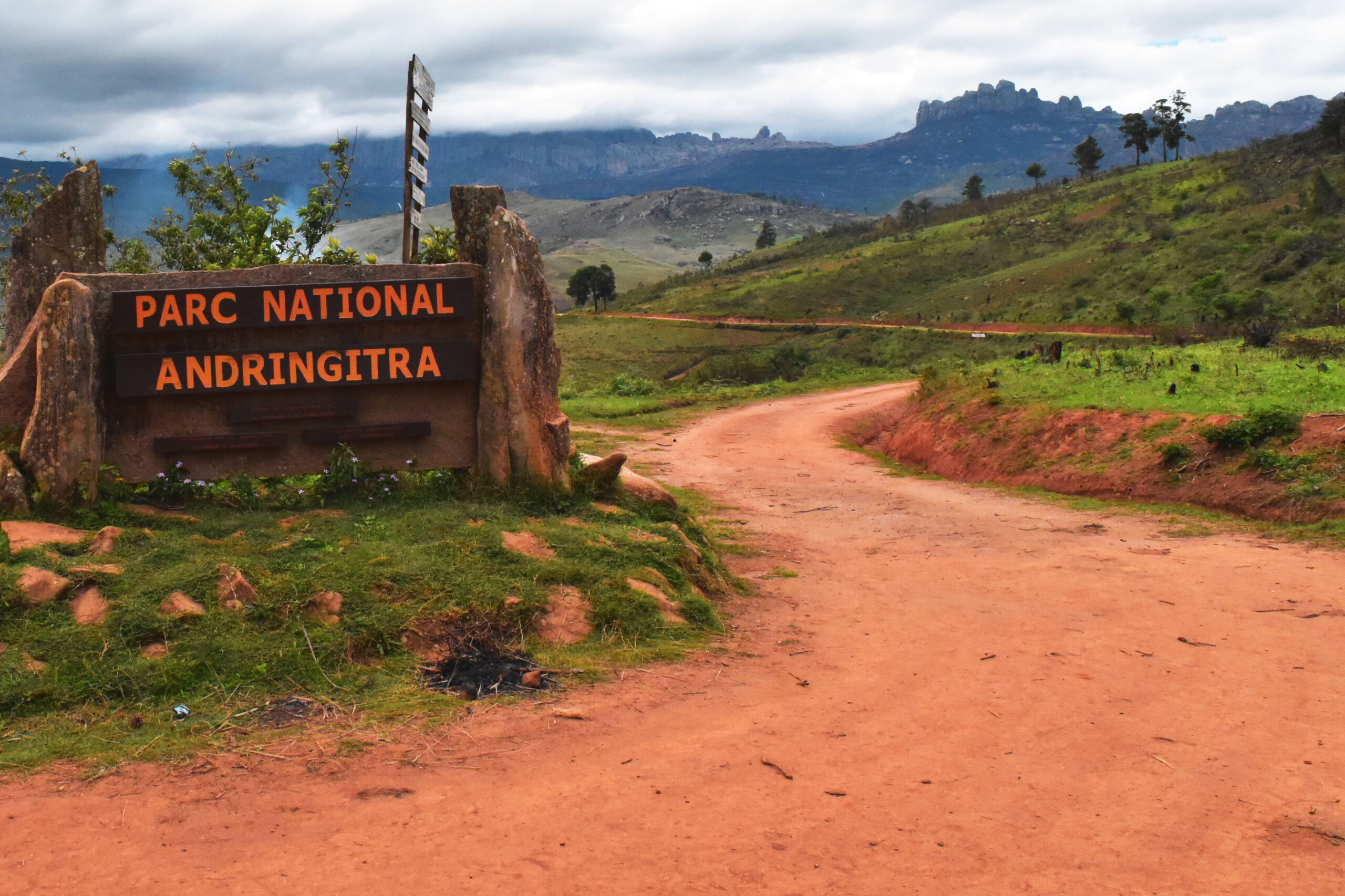
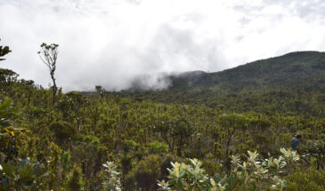
Early morning departure in the direction of the Andringitra Massif. In Ambalavao visit of the craft manufacturing workshop of wild silk and Antemoro paper. From Ambalavao, we will take the 45 km long dirt road leading to the entrance of the National park. Given the poor condition of the road we can only drive very slowly. However, this means that you will have plenty of time to contemplate the beautiful landscape that we will pass on our way! In Namoly we will enter the park and begin our first day of hiking with views of the queen and king sacred waterfalls , continuing the hike through the Andohariana plateau and ending at the camp site. The walking time is about 4 hours. We will overnight in Andriampotsy at the foot of huge granite cliffs, at an altitude of 2050 m. Due to the altitude of this camp site, nights here are very cold and temperatures can drop below 0ºC in July and August. Warm clothes and a good sleeping bag are therefore essential!Day 2
9 hours walk and 1 000m+ of ascent& 1 400m- of descent
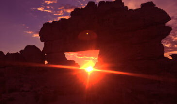
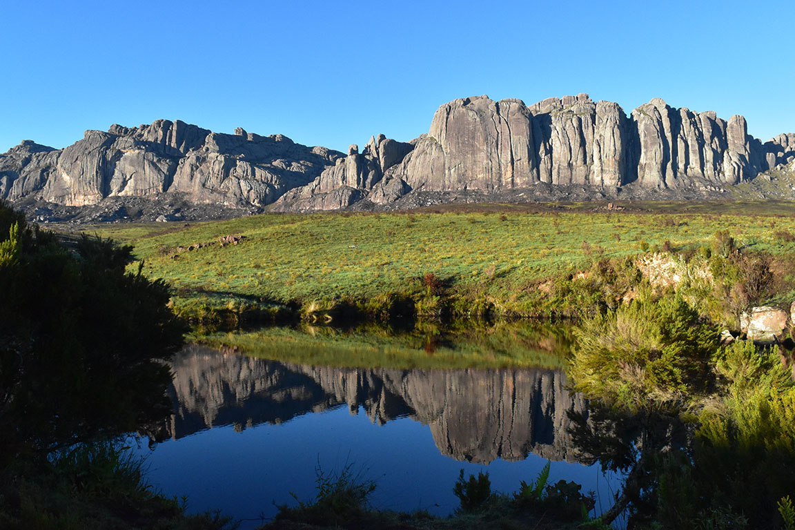
After an early morning start you will tackle the ascent of Peak Boby. After only 2h 30minutes walk you will reach the peak where you can enjoy a magnificent panorama of the entire region. In very good weather, you can even see the Isalo massif a bit further south. The path to the summit consists of quite steep stone steps and requires a good level of fitness; some scrambling over rocks is needed during the last part of the ascent near the top. The summit is located on a ridge which is very exposed to the eastern climate influences with a lot of humidity which can quickly cover the summit in clouds. Unfortunately this could spoil the views during the beautiful climb to this prestigious peak of Madagascar. We will descend from the peak via a circuit called ’extra-terrestrial’. Once the walk begins you will soon understand why this circuit has been named ‘extra-terrestrial’: you will discover a strange surreal lunar landscape setting in mountainous surroundings that you won’t easily forget. On the descent from this beautiful landscape you will cross the forest of endemic palm trees called ‘ravenea glauca’ and continue to the campsite of Iantaranomby for the night, at an altitude of 1600m. The campsite is located next to a river, you can jump in for a refreshing swim!Day 3
5 hours walk and 140m+ of ascent& 850m-of descent
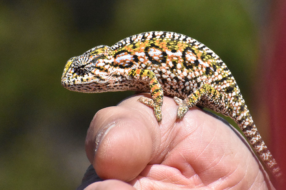
After breakfast, we will leave the last campsite and head down to the Tsaranoro Valley. Along the way, it might be possible to spot elephant’s foot plants, different species of aloe and lizards and appreciate the view of the open valley with the Tsaranoro massif in the background. Once at the foot of the massif, the path continues through several villages of Barabory, a mix of the Bara and Betsileo cultures. Upon arrival in the village of Morarano, you will continue the hike cross this beautiful valley ending at Camp Catta or Tsara Camp.Note : From here, you have several possibilities: either to stay overnight in this magnificent valley or to carry on to the South heading to Ranohira for about 4 hours of drive or to go back to Ambalavao (2 hours drive) or Fianarantsoa (3 to 4 hours drive).
No details found.
No details found.


No Details Found
There are no reviews yet.